MDRI Expedition #2 – Price, Swindle, and Aristazabal Islands (Kitasoo/Xai’xais and Gitga’at First Nation Territories)
On September 9th, 2020, our Marine Debris Removal Initiative (MDRI) fleet of nine ships belonging to members of the Small Ship Tour Operators Association (SSTOA), and ~80 crew departed Port Hardy for the second of two marine debris removal expeditions. Both expeditions were funded by the Government of BC’s Clean Coast, Clean Waters Initiative Fund (CCCW). This expedition would take us further north into the traditional territories of the Kitasoo/Xai’xais and Gitga’at First Nations, and the Great Bear Rainforest.
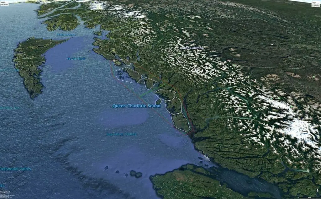
The outer coast islands we would be targeting were the west-facing shorelines of Price, Swindle, and Aristazabal Islands. These islands are among the most remote and rugged of the BC coast, and where we expected to find vast amounts of marine debris due to where they are situated relative to the North Pacific Gyre and the “Pacific Drift”.

The North Pacific Gyre (NPG), is a clockwise-rotating ocean circulation system, located between the equator and ~50 degrees north, and is formed by four ocean currents. The North Equatorial Current flows from west to east along the equator; the Kuroshio Current flows north along the west coast of Japan; and the North Pacific Current (also known as the “Pacific Drift”), flows from west to east between 30 degrees and 50 degrees north.
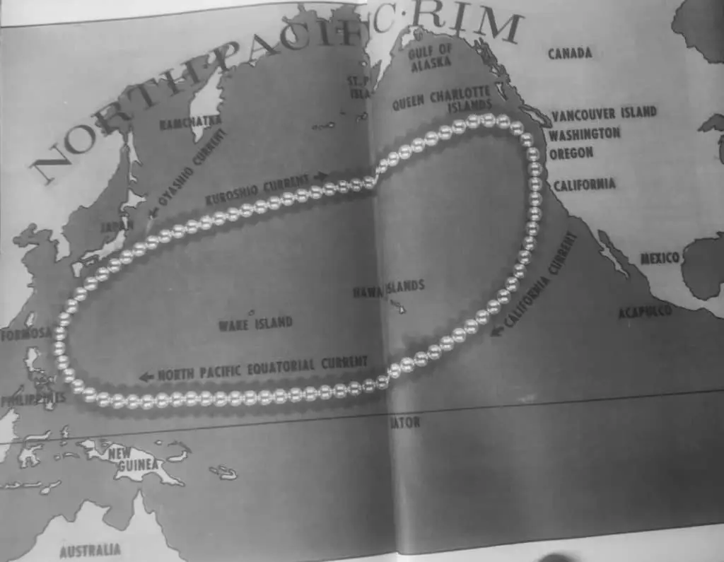
Upon reaching the coast of British Columbia, this current splits into the north-flowing Alaska Current, and the south-flowing California Current. In the context of marine debris, the take-home message here is that the outer coasts of British Columbia are subject to a slow but persistent ocean current coming from the western Pacific (i.e., Indonesia, Philippines, China, Korea, Japan, and Russia), and all the marine debris from these regions that comes with it.
If you look at a map of coastal British Columbia, you’ll notice a large area between Vancouver Island and Haida Gwaii which, bounded by the mainland shore, is known as Queen Charlotte Sound. It’s the west-facing shorelines of Queen Charlotte Sound (also Vancouver Island and Haida Gwaii), that are subject to this persistent flow of warm water and marine debris from the western Pacific Ocean that were the focus of our two 21-day MDRI expeditions in August and September of 2020.
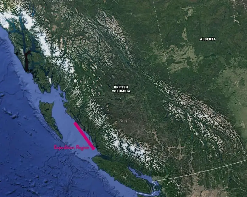
As we travelled north from Port Hardy, our crew aboard the schooner Passing Cloud had ample time to study the charts of Price and Aristazabal Islands (both located northwest of Bella Bella), and a few observations quickly stood out for us. First, the west coast of both islands are fully exposed to open-ocean swells, and therefore weather would play a deciding factor in our activities on a daily basis; second, both shorelines are rocky, rugged, complex, and generally unforgiving. Finally, large sections of both islands are literally uncharted, and would require our crews to be exceptionally careful as we navigated these areas.
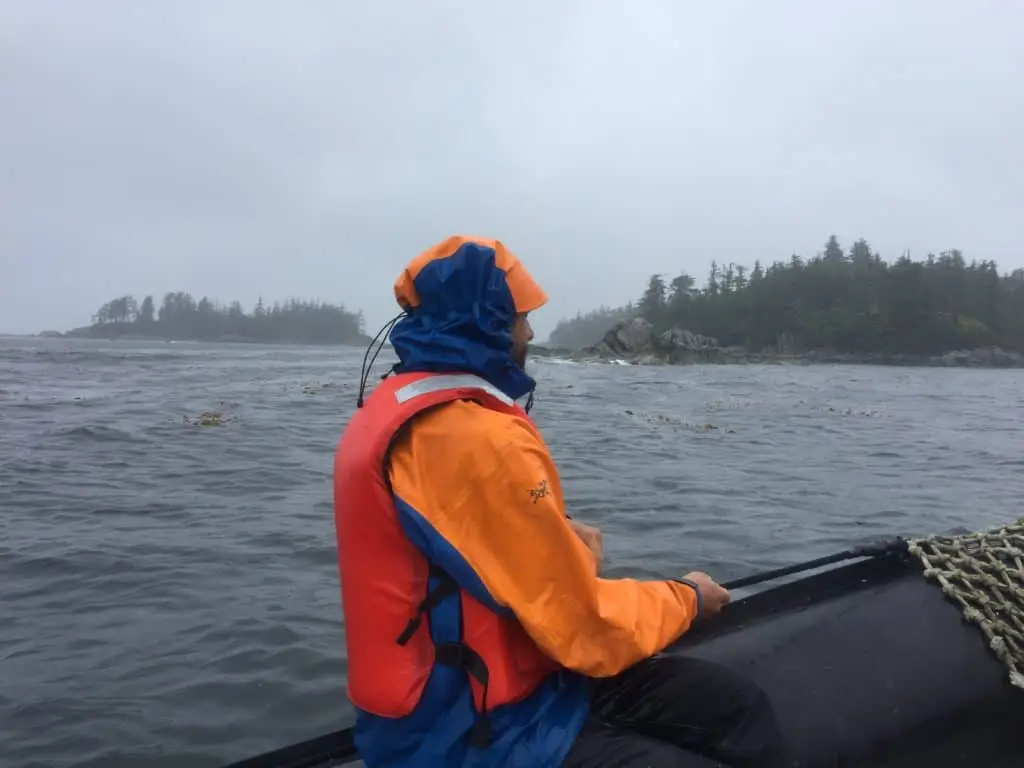
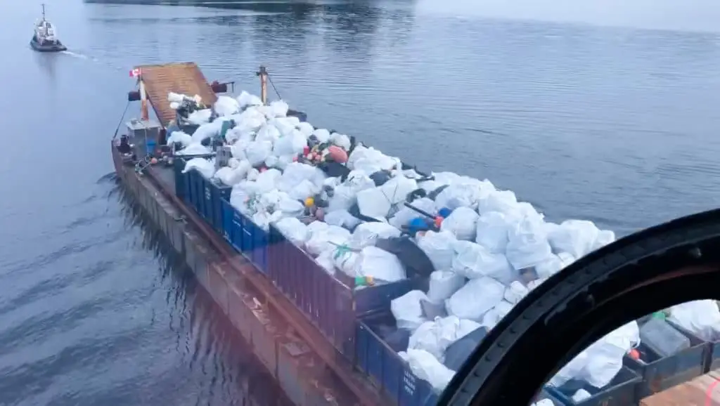
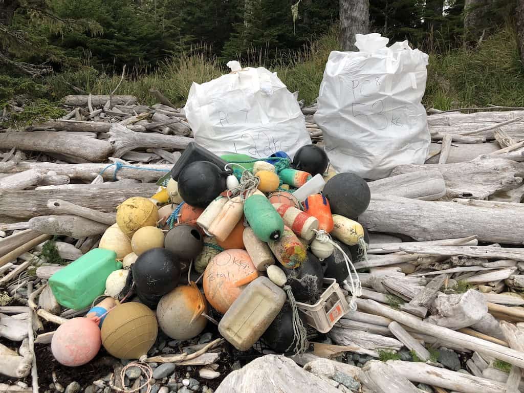
Two days after leaving Port Hardy, the MDRI fleet vessels spread out between southern Price Island and northern Aristazabal Island, and dove into debris removal. After the first two days, we noticed some big differences from our first expedition. First, our crews were now seasoned professionals at this work, having learned and developed numerous systems and efficiencies during our first 3 weeks of operations. Second, we were encountering more marine debris. As a result, collectively our MDRI fleet was collecting, weighing, and bagging ~10,000 kg of debris, every day! However, we still needed to get all the lift bags off of the shore and onto the barge, and our weather window was closing.
Storm Approaching – Race to the Finish
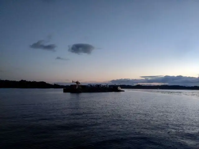
Throughout both expeditions, we used satellite-based email to download GRIB files (weather maps), and 7-day marine weather forecasts. On September 16th, the updated forecast showed that a major storm was approaching, coinciding almost exactly with the Fall equinox. In a matter of days, we could expect winds in the range of 40-50 knots, and oceans swell reaching 4-5 metres, putting at risk our ability to finish getting our lift bags off the shore. In response, both the tug/barge company (Heiltsuk Horizon), and helicopter contractor (Airspan Helicopters), agreed to arrive a full day earlier than we had scheduled; unfortunately, fog and smoke from forest fires significantly delayed the helicopter.
Finally, on Sept 19th, we began lifting bags. By noon on September 21st, we had finished Swindle and Aristazabal Islands and were working our way south along the west coast of Price Island. The arrival of the storm had been pushed back by one day, and would now arrive late on the 22nd. But, we urgently needed to finish Price Island today, so that early the following day we could return to the Groose Group Islands (~25 nautical miles to the south), where heavy fog had prevented us from completing our lift operations at the end of the Expedition #1. Approximately 10,000 kg of bagged debris remained there, and now was now being threatened by the impending weather. By ~6:00 PM on the 21st, we realized that we were going to run out of daylight before we could finish Price Island. In a last-ditch effort, we asked all ground crews to do everything they could to combine lift bags, lift sites, and even transport lift bags back to our ships by skiff possible.
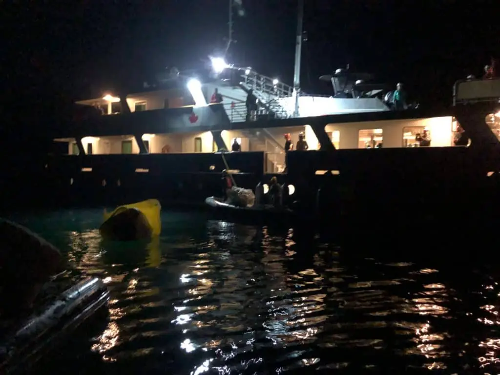
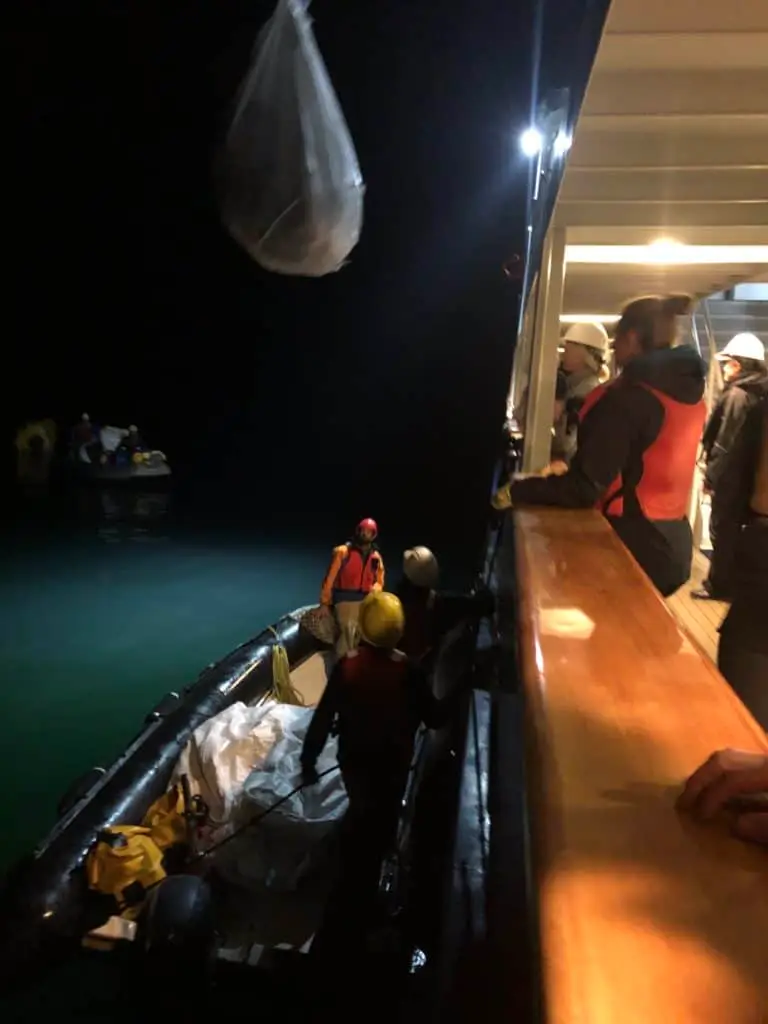
By ~8:00 PM, it was nearly dark, the helicopter had shut down, and we still had six lift bags remaining in two sites. Fortunately, the skies were clear, seas were calm, and the crews of Passing Cloud, Island Roamer, and Island Odyssey, with headlamps and spotlights, headed off in their skiffs to retrieve these last bags so that the fleet could depart that night or early the next morning. These crews proceeded to break down the remaining lift bags into smaller (lighter) loads, which were then carried or rolled in our skiffs. Once in the skiffs, crews travelled a short distance to the MV Cascadia, where the bags were craned off and temporarily stowed on her aft deck. With a spectacular moonrise on the first day of Fall, and an enormous sense of teamwork, accomplishment, and adventure, the atmosphere was electric.
Back aboard the Passing Cloud, we decided to spend the night where we were anchored near the southern end of Price Island. The next morning, we were underway by 4:00 AM and on route to the Goose Group, ~4 hours away. By 8:00 AM we were on scene and the helicopter was already flying. And by noon, all of our lift bags had been lifted on the barge, and our MDRI fleet began heading for safe anchorages to wait out the storm. Mission accomplished!